• Home
  • About
    • About the Council
    • Staff
    • Board of Directors
    • Publications
  • Learn
    • Watershed Information
    • Maps and Resources
    • Discover Your Watershed
    • Youth Education Program
  • Restore
    • Current Projects
      • Elijah Bristow State Park
      • Coal Creek
      • Staley Creek
      • Gorrie Creek Riparian Restoration
      • Thurston Hills Oak Restoration
      • Dorris Ranch
    • Past Projects
  • Engage
    • Links
    • Volunteer Opportunities
    • Support Us
    • Job Announcements
    • Watershed Stories Blog
    • Recreation
Skip to content
MFWWC Logo
Donate
Calendar
  • Email
  • Facebook
  • Instagram
  • Home
  • About
    • About the Council
    • Staff
    • Board of Directors
    • Publications
  • Learn
    • Watershed Information
    • Maps and Resources
    • Discover Your Watershed
    • Youth Education Program
  • Restore
    • Current Projects
      • Elijah Bristow State Park
      • Coal Creek
      • Staley Creek
      • Gorrie Creek Riparian Restoration
      • Thurston Hills Oak Restoration
      • Dorris Ranch
    • Past Projects
  • Engage
    • Links
    • Volunteer Opportunities
    • Support Us
    • Job Announcements
    • Watershed Stories Blog
    • Recreation
Menu

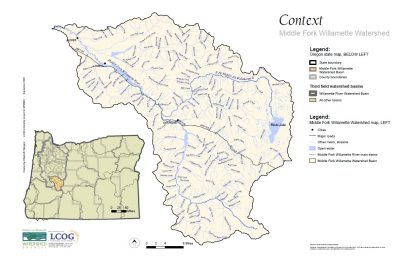
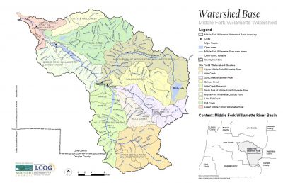
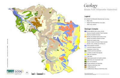
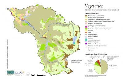
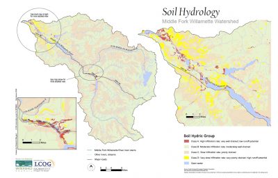
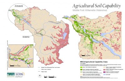
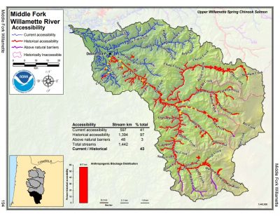
Maps and Resources

Middle Fork Watershed Maps

Click on the images below for a full resolution, downloadable map.

context
Geography
Geology
Vegetation
Soil Hydrology
Soil Capability

Accessibility Map

Printable Map (PDF)

Assessments and Publications

  • Career Pathways Brochure
  • Willamette River Report Card (2015)
  • Oregon Forest Practices Act
  • EDRR Weed Guide
  • Willamette Basin Planning Atlas

Inside this section

  • Learn
  • Youth Education Program
  • Curriculum and Resources
  • Stewards Curriculum
  • Eggs to Fry
  • Education Partners
  • Outdoor School
  • Students and Schools
  • Outdoor School 2019
  • Watershed Information
  • Maps and Resources
  • Discover Your Watershed

Latest From the Blog

  • Jul
    16
    Planning for Fire: How Land Managers are Working for a Resilient Watershed
  • Jul
    16
    The History of Elijah Bristow: From Pre-Colonization to Today
  • Mar
    31
    Favorite Plants of Western Cascade Butterflies with Tanya Harvey
View all

Recent Posts

  • Planning for Fire: How Land Managers are Working for a Resilient Watershed
  • The History of Elijah Bristow: From Pre-Colonization to Today
  • Favorite Plants of Western Cascade Butterflies with Tanya Harvey
  • Fermenting Ideas with David Lewis
  • Connecting When We Can’t be Together

Recent Comments

    Archives

    • July 2021
    • March 2021
    • November 2020
    • May 2020
    • April 2020
    • November 2019
    • July 2019
    • May 2019
    • October 2018
    • June 2018
    • March 2018
    • February 2018
    • January 2018
    • September 2017
    • August 2017
    • July 2017

    Categories

    • Uncategorized

    Meta

    • Log in
    • Entries feed
    • Comments feed
    • WordPress.org
    Middle Fork Willamette Watershed Council Logo
    655 A Street
    Suite A/B
    Springfield, OR 97477
    458-215-8200
    [email protected]
    • Home
    • About
      • About the Council
      • Staff
      • Board of Directors
      • Publications
    • Learn
      • Watershed Information
      • Maps and Resources
      • Discover Your Watershed
      • Youth Education Program
    • Restore
      • Current Projects
        • Elijah Bristow State Park
        • Coal Creek
        • Staley Creek
        • Gorrie Creek Riparian Restoration
        • Thurston Hills Oak Restoration
        • Dorris Ranch
      • Past Projects
    • Engage
      • Links
      • Volunteer Opportunities
      • Support Us
      • Job Announcements
      • Watershed Stories Blog
      • Recreation
    Join Us!
    • Email
    • Facebook
    • Instagram
    Copyright © 2023 Middle Fork Willamette Watershed Council. All rights reserved...