US Forest Service Middle Fork Ranger District, Oregon Dept. of Fish & Wildlife
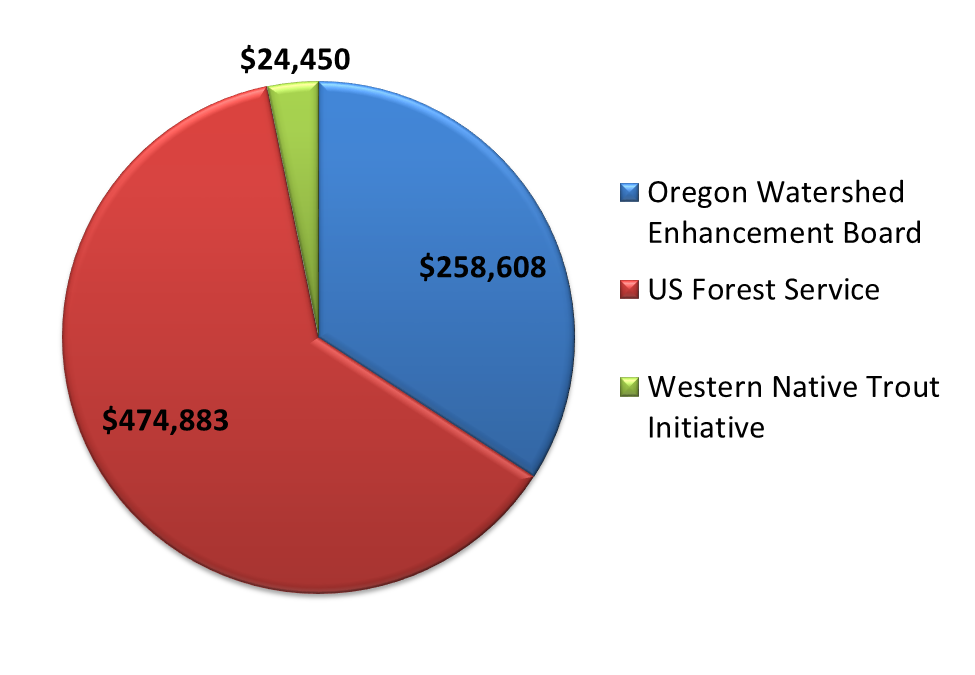
Funding
Summary
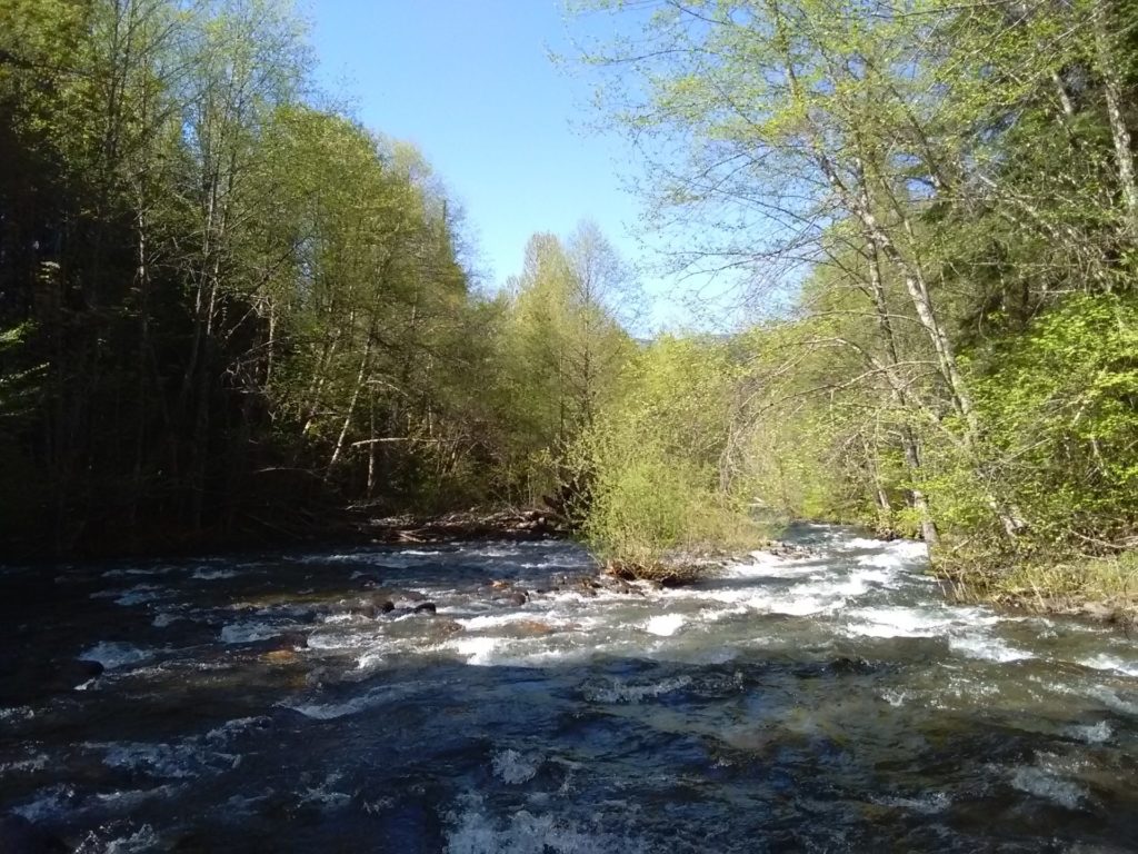
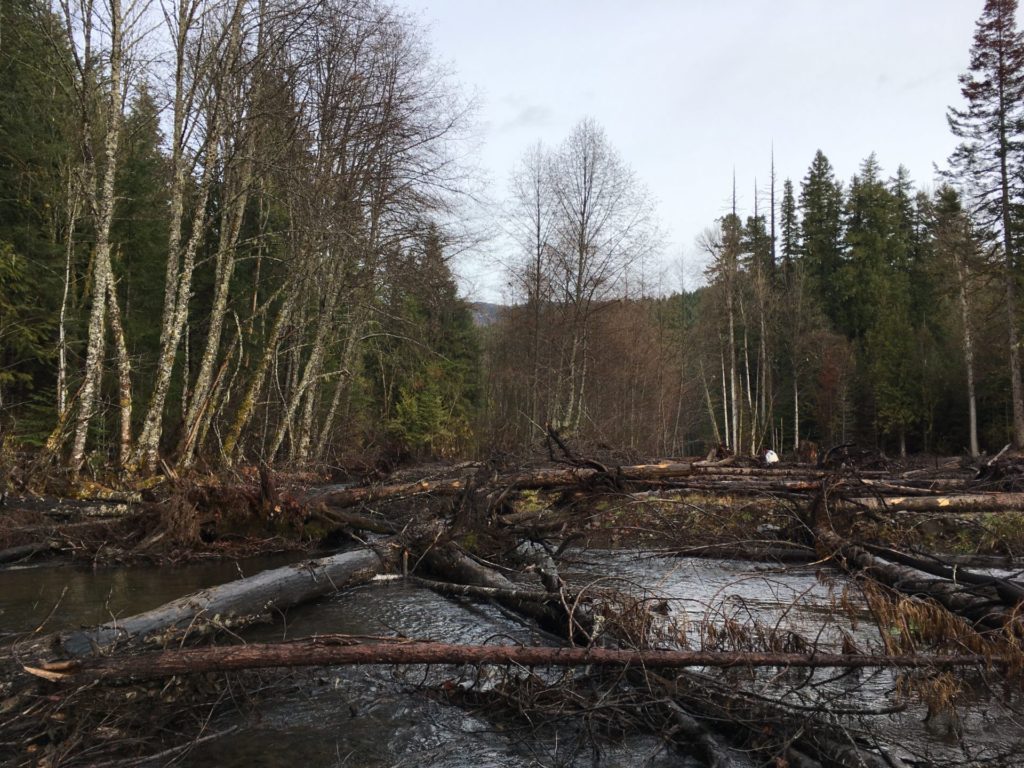
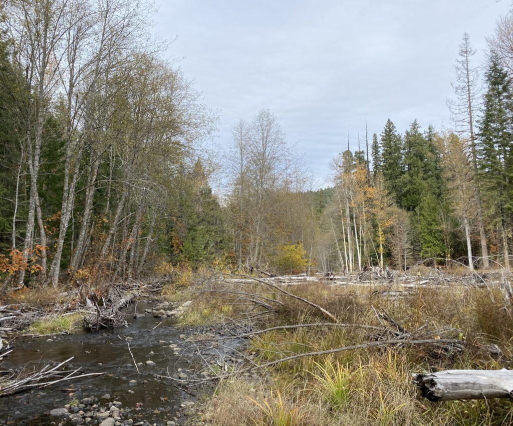
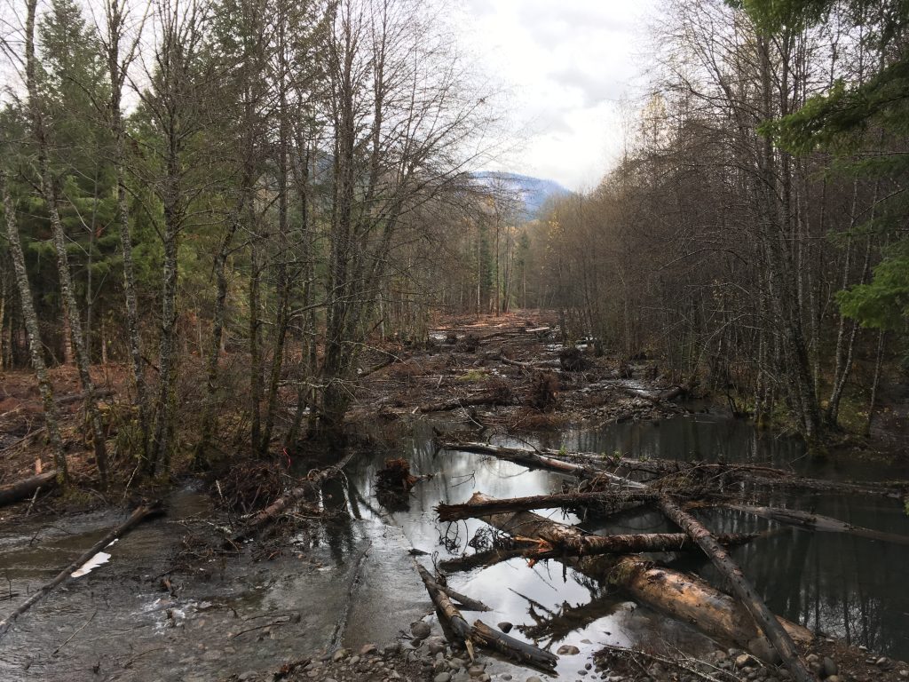
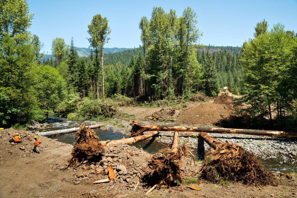
Rivers and streams naturally meander, spread out, and create new paths. During spring runoff and floods they often overflow their banks and spill onto the floodplain. In the summer, water that runs through floodplains provides a cool escape for fish and other species. Floodplains also slow water down protecting downstream locations from high flows. In Staley Creek, a tributary of the upper Middle Fork Willamette River, those processes and benefits had been lost because of historic land use practices that led to straightening the channel and building berms to disconnect it from its floodplain. To remedy that, in July and August 2017 we worked closely with the US Forest Service Middle Fork Ranger District and Haley Construction Company to remove the berms, fill in the scoured out channels, and place hundreds of pieces of large wood in the stream and on the floodplain. The final product is 46 acres of floodplain reconnected over one stream mile. We expect this new, dynamic landscape to dampen flood events, raise the water table and increase flood water storage. By restoring these hydrologic processes, we expect that habitat conditions will improve and, in turn, benefit fish and wildlife. Through monitoring efforts, the Middle Fork Ranger District has observed the return of bull trout and harlequin ducks!
Monitoring
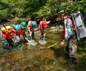
Monitoring is a key part of any project we undertake and we are continuing to partner with the US Forest Service to do regular monitoring at both Coal and Staley Creeks. As information becomes available from this monitoring we will share it with you on our Monitoring Page.
Photos
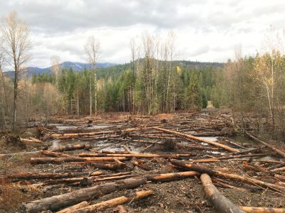
Before and after photos show a change fromdisconnected floodplain, no large wood and an incised channel to wetted floodplain, lots of large wood and no dominant channel.
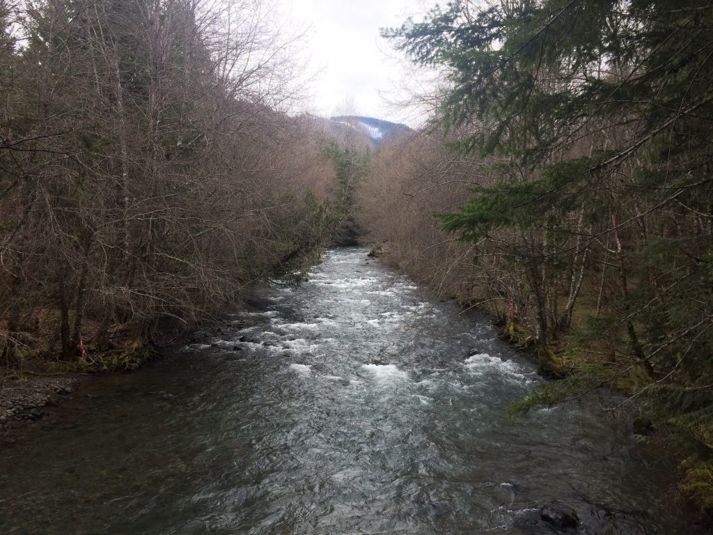
Before -2017
After - 2018
After - 2020
Before -2017
After - 2018
After - 2020
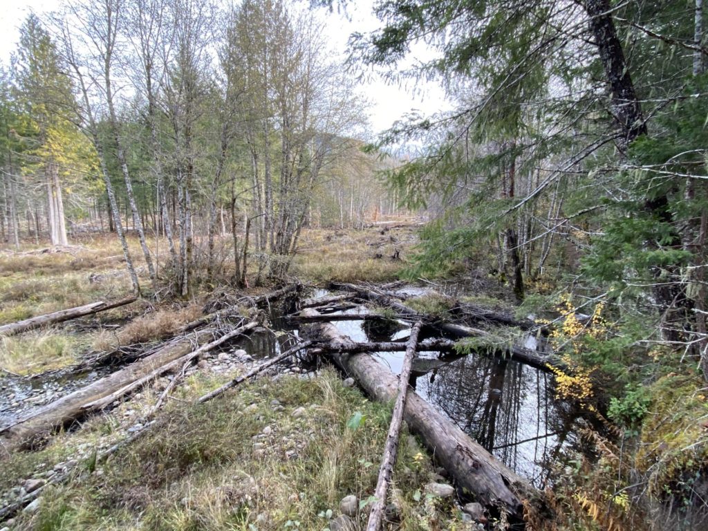
Before
During
After
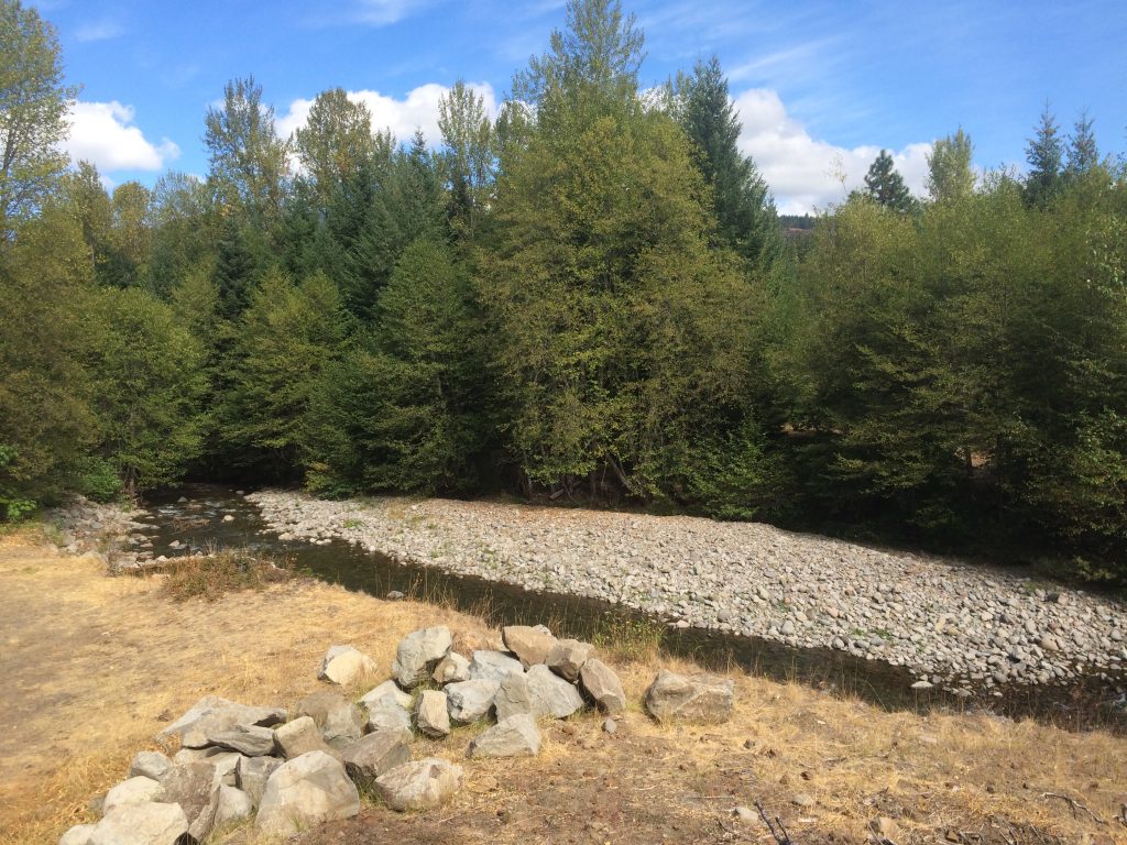
Check out the gallery below for photos that highlight our work at Staley Creek. For even more please visit our facebook album.
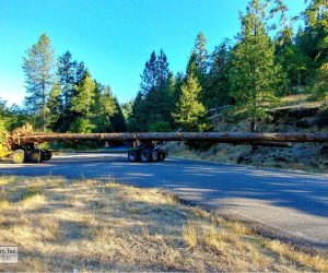
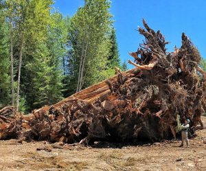
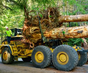
Some of the trees utilized in Staley Creek were nearly 125’ long! (Photo by Haley Construction)
Fish Salvage at Staley Creek
USFS Fish Biologist Matt Helstab looks up at the root wads that were placed throughout the floodplain. (Photo by Kate Meyer)
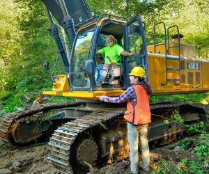
MFWWC Project Manager Audrey Squires discusses the plan with a Haley Construction equipment operator.
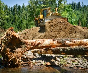
To reconnect Staley Creek to its floodplain, removing berms was essential.
To lower the high areas, we had to remove some vegetation from the project area which we then built into log jams.
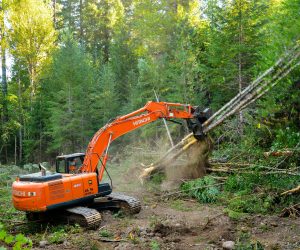
Dynamic father-daughter duo, Randy and Jessi Haley, haul large trees with rootwads to the project.
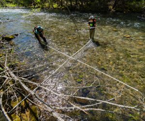
Lisa Kurian, USFS Hydrologist, and Audrey Squires, MFWWC Restoration Projects Manager, conduct pre-project monitoring. (Photo by Matt Helstab)
Video
Pre-project aerial video
Post-project aerial video
River otters!
Floodplain Research
Cluer, B & Thorne, C, 2013. A stream evolution model integrating habitat and ecosystem benefits. River Research and Applications, 30:135-154. Link
Powers, PD, Helstab, M, & Niezgoda, SL, 2018. A process-based approach to restoring depositional river valleys to Stage 0, an anastomosing channel network. River Research and Applications, 2018:1-1. Link